Home > Tag > Announcement

Welcome to the official site for FEMA's Great Lakes Coastal Flood Study, the comprehensive storm and wind study of the Great Lakes basin for the purpose of updating the coastal flood hazard information and Flood Insurance Rate Maps (FIRM) for Great Lakes coastal communities. Below you’ll find a list of the most recent meetings with their agendas, links to preliminary maps, and presentations. To the left you’ll find additional Great Lakes Coastal Flood Study content.

FEMA created this self-guided tutorial on coastal flood mapping that provides important information to coastal communities and their residents. FEMA’s “Coastal Hazards and Coastal Mapping: A Visual Guide” is a glossary of coastal mapping terms and a companion to the tutorial.

View all posts by lake: Lake Superior | Lake Michigan | Lake Huron | Lake St. Clair | Lake Erie | Lake Ontario

View all posts by state: Minnesota | Wisconsin | Illinois | Indiana | Michigan | Ohio | Pensylvania | New York


Posts

Lake Erie Consultation Coordination Officer and Open House Meetings

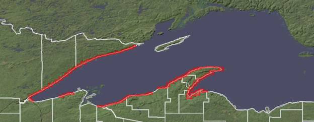
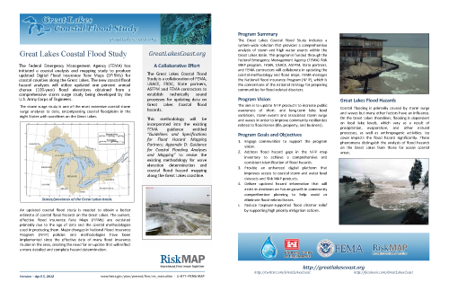
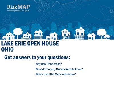
FEMA invites Lake Erie Shoreline public officials, property owners, realtors, lenders, and insurance agents to learn more about flood risk and hazard mitigation within their community at upcoming CCO and Open House meetings. The CCO meetings are hosted to provide county officials with an opportunity to review a recently completed preliminary Flood Insurance Study (FIS) and its accompanying preliminary Flood Insurance Rate Maps (FIRMs). The FIS and the FIRMs provide base flood (also known as the one percent annual chance event) information, designate areas that are subject to significant flood hazards within the county, and offer information that public officials may use when permitting development in the floodplain. During the CCO meetings, any changes in flood risk will be explained and participants will have an opportunity to provide feedback on the FIRMs and FIS report.

Following the CCO meetings, Open House meetings are hosted for the public to meet with representatives from various local, state, and federal agencies who will provide the most current information about flood risk, flood insurance, floodplain development regulations, and the process for floodplain mapping within their county. The newly prepared preliminary FIRMs will be on display. See FEMA’s Preliminary Flood Hazard Data page and FEMA’s Preliminary Flood Hazard Layer mapping application for additional information.

Lorain County CCO Meeting Presentation [.pdf]
Tuesday, November 28, 2017
CCO 2:00-4:00pm, Open House 5:00-7:00pm
Sunset Terrace at Lakeview Park
1800 W Erie Ave
Lorain, OH 44052

Erie CountyCCO Meeting Presentation [.pdf]
Wednesday, November 29, 2017
CCO 2:00-4:00pm, Open House 5:00-7:00pm
Erie County Facilities Building
3rd Floor Commission Chambers
2900 Columbus Avenue
Sandusky, OH 44870

Cuyahoga CountyCCO Meeting Presentation [.pdf]
Thursday, November 30, 2017
CCO 2:00-4:00pm, Open House 4:30-6:30pm
Cleveland Public Library – Martin Luther King, Jr Branch
1962 Stokes Blvd.
Cleveland, OH 44106

Lake CountyCCO Meeting Presentation [.pdf]
Tuesday, December 5, 2017
CCO 2:00-4:00pm, Open House 5:00-7:00pm
Lake Erie College
Arthur S. Holden Center – Coe Conference Room
391 West Washington Street
Painesville, OH 44077

Ashtabula CountyCCO Meeting Presentation [.pdf]
Wednesday, December 6, 2017
CCO 2:00-4:00pm, Open House 5:00-7:00pm
Ashtabula County Courthouse Commissioners Room
25 W. Jefferson Street
Jefferson, OH 44047

Ottawa/Sandusky CountiesCCO Meeting Presentation [.pdf]
Thursday, December 7, 2017
CCO 2:00-4:00pm, Open House 5:00-7:00pm
County Courthouse EOC Meeting Room
315 Madison St.
Port Clinton, OH 43452

Lake Michigan Work Map Meetings

Local officials and technical stakeholders are being invited to community meetings to review and comment on FEMA’s draft coastal flood hazard work maps for the Lake Michigan Shoreline. FEMA’s outreach meetings for the 2017 work maps start in early July.

Each meeting will include a summary of the draft work maps, Q&A, and a breakout for review of community-specific data via printed and online maps. Staff members and officials representing villages, cities, and county government, regional organizations, non-governmental bodies, neighborhood associations, and harbor and shoreline protection engineers are encouraged to attend and to provide feedback within the 60-day comment period.

For more information:
KEN HINTERLONG
Senior Engineer, Risk Analysis
FEMA Region 5
312-408-5529
ken.hinterlong@fema.dhs.gov

Additional Information:
Great Lakes Coastal Resilience Planning Guide: http://www.greatlakesresilience.org/
USACE High Resolution Oblique Aerial Images: https://greatlakes.erdc.dren.mil/

Illinois

Lake County
Monday, July 10, 1:00-3:00pm
Highland Park City Council Chambers
1707 St. Johns Ave
Highland Park, IL 60035

Cook County
Tuesday, July 11, 9:30-11:30am
Evanston Civic Center
2100 Ridge Ave
Evanston, IL 60201

Indiana

Porter & La Porte Counties
Wednesday, July 12, 9:30-11:30am
Training Room
Indiana Dunes National Lakeshore
1100 N. Mineral Springs Road
Porter, IN 46304

Lake County
Wednesday, July 12, 2:00-4:00pm
Clipper Room
Hammond Port Authority
701 Casino Center Drive
Hammond, IN 46320

Wisconsin

Racine & Kenosha Counties
Wednesday, July 26, 9:30-11:30am
Northside Library Activities Room A
1500 27th Ave.
Kenosha, WI 53140

Milwaukee County
Wednesday, July 26, 2:00-4:00pm
Bay View Library Community Room
2566 S Kinnickinnic Ave.
Milwaukee, WI 53207

Ozaukee & Sheboygan Counties
Tuesday, August 8, 9:30-11:30am
Rocca Meeting Room
Mead Public Library
710 N. 8th Street
Sheboygan, WI 53081

Manitowoc & Kewaunee Counties
Tuesday, August 8, 2:00-4:00pm
Wells Fargo Conference Room – Lakeshore Building
Lakeshore Technical College
1290 North Avenue
Cleveland, WI 53015

Door County
Monday, August 21, 2:00-4:00pm
Sturgeon Bay Library, JLG Room
107 S 4th Avenue
Sturgeon Bay, WI 54235

Oconto & Marinette Counties
Tuesday, August 22, 9:30-11:30am
Oconto County Courthouse, Room 1004
301 Washington Street
Oconto, WI 54153

Brown County
Tuesday, August 22, 2:00-4:00pm
Brown County Central Library, Combined Central Meeting Room ½
515 Pine Street
Green Bay, WI 54301

Michigan

Mackinac County
Tuesday, August 8, 2:00-4:00pm
St. Ignace Public Library
110 West Spruce Street
St. Ignace, MI 49781

Charlevoix & Emmet Counties
Wednesday, August 9, 9:00-11:00am
Charlevoix Public Library
220 West Clinton Street
Charlevoix, MI 49770

Grand Traverse & Antrim Counties
Wednesday, August 9, 2:00-4:00pm
Torch Lake Township Hall
2355 N US-31
Kewadin, MI 49648

Leelanau County
Thursday, August 10, 9:00-11:00am
Leelanau County Government Center
Lower Level Community Meeting Room
8527 East Government Center Drive
Suttons Bay, MI 49682

Berrien & Van Buren Counties
Monday, August 28, 3:00-5:00pm
St. Joseph Public Library – Norris Room
500 Market Street
St. Joseph, MI 49085

Allegan & Ottawa Counties
Tuesday, August 29, 2:00-4:00pm
Herrick District Library – Large Meeting Room
300 South River Street
Holland, MI 49423

Muskegon County
Wednesday, August 30, 10:30am-12:30pm
Hackley Public Library – Lower Level
316 West Webster Avenue
Muskegon, MI 49440

Mason & Oceana CountiesWork Map Meeting Presentation [.pdf]
Tuesday, September 19, 9:00-11:00am
Mason County Airport
Conference Room
5300 W. U.S. 10
Ludington, MI 49431

Manistee & Benzie CountiesWork Map Meeting Presentation [.pdf]
Tuesday, September 19, 2:00-4:00pm
Manistee County Sheriff’s Office
Training Room
1525 E. Parkdale Ave.
Manistee, MI 49660

Delta CountyWork Map Meeting Presentation [.pdf]
Thursday, September 21, 10:30-12 noon
Delta County Board Room
2920 College Avenue
Escanaba, MI 49829

Summer 2016 Newsletter Announces Lake Erie Updates and Meetings

Great Lakes Coastal Flood Study releases the Summer Newsletter announcing Project Updates and Meetings for communities along Lake Erie, all detailed in the newsletter below.

The Newsletter above is posted on the Newsletters page.

Posted in Newsletters.
Tags: , .


Summer 2012 Newsletter Announces GLCFS Discovery Meetings

Great Lakes Coastal Flood Study releases the Summer Newsletter announcing 24 Discovery Meetings for communities along Lake Erie, Lake Michigan and Lake St. Clair that will further engage stakeholders and the public in the Discovery Process, all detailed in the newsletter below.

The Newsletter above is posted on the Newsletters page.

Agenda for Lake Michigan Technical Workshops

The Great Lakes Coastal Flood Study recently announced a series of Technical Workshops around the Great Lakes Basin. The agenda for the first batch of workshops is posted below.

Spring 2012 Newsletter Announces GLCFS Technical Workshops

Great Lakes Coastal Flood Study releases the first quarterly newsletter. This newsletter announces the technical workshops across the Great Lakes Basin that will seek feedback from technical experts regarding the Great Lakes Coastal Flood Study.

The Newsletter above is posted on the Newsletters page.

GREAT LAKES COASTAL FLOOD STUDY TECHNICAL WORKSHOPS:

Lake Erie
Northeastern Ohio
Tuesday, June 12, 2012 – 1 to 5 PM
Ashtabula County District Library, Geneva Branch
860 Sherman Street
Geneva, OH 44041

North Central Ohio
Wednesday, June 13, 2012 – 1 to 5 PM
Lorain County Library System, South Lorain Branch
2121 Homewood Drive
Lorain, OH 44055

Northwestern Ohio
Thursday, June 14, 2012 – 1 to 5 PM
Lucas County Public Library, South Branch
1736 Broadway Street
Toledo, OH 43609

New York & Pennsylvania
Workshop Details to be Determined

Lake Michigan
Southeastern Wisconsin
Tuesday, May 8, 2012 – 1 to 5 PM
Milw. Metropolitan Sewerage District Commission Rm
260 West Seeboth Street
Milwaukee, WI 53204

Northeastern Wisconsin
Wednesday, May 9, 2012 – 1 to 5 PM
Northeast Wisconsin Technical College, CB 213 A & B
2740 West Mason Street
Green Bay, WI 54307

East Central Wisconsin
Thursday, May 10, 2012 – 8 AM to 12 PM
Lakeshore Technical College, Wells Fargo Conf. Room
1290 North Avenue
Cleveland, WI 53015

Illinois & Indiana
Workshop Details to be Determined

Northwestern Michigan
Tuesday, June 5, 2012 – 1 to 5 PM
Grand Traverse County Civic Center Meeting Room
1113 West Civic Center Drive
Traverse City, MI 49686

West Central Michigan
Wednesday, June 6, 2012 – 1 to 5 PM
West Shore Community College, North Lounge, Administrative and Conference Building
3000 North Stiles Road
Scottville, MI 49454

Southwestern Michigan
Thursday, June 7, 2012 – 1 to 5 PM
Lake Michigan College, South Haven Campus, Rm 141
125 Veterans Blvd.
South Haven, MI 49090

Lake St. Clair
Eastern Michigan
Wednesday, July 11, 2012 – 1 to 5 PM
Macomb Community College (Center Campus), Lorenzo Cultural Center
44575 Garfield Road
Clinton Township, MI 48038

Storm Surge and Wave Modeling Fact Sheet Released

Great Lakes Coastal Flood Study announces the release of a new fact sheet. The fact sheet summarizes the storm surge and wave modeling processes used for the Great Lakes Coastal Flood Study.

The Fact Sheet above is posted on the Fact Sheet page.

Outreach Page Expanded at greatlakescoast.org

We’ve expanded the Outreach Page of GreatLakesCoast.org!

The Outreach Page now contains the following sub-sections:

Please check out the new sections using the links above or go to the Outreach Page to see an overview of what each section is about. Thanks!

NVision Solutions Contracted by U.S. Army Corps of Engineers to Help with Flood Plain Management

via http://www.directionsmag.com/pressreleases/nvision-solutions-contracted-by-corps-of-engineers-for-great-lakes-flood-pl/182546

NVision Solutions, Inc. has been awarded a contract by the U.S. Army Engineer Research and Development Center (ERDC) in Vicksburg, MS, to provide aerial-data collection services for the entire Great Lakes Region coastline to help with flood plain management. NVision will provide seamless, high-resolution oblique color images along approximately 6,000 miles of the coastline of all five Great Lakes within the U.S. The flights will test the new ERDC system and support other U.S. Army Corps of Engineer (USACE) activities. NVision has partnered with Aerotec, LLC to use their specialized Partenavia P68C fixed-wing aircraft and FAA-certified flight operations team. “We are pleased to partner with Aerotec as we have routinely partnered with them on several geospatial engineering projects,” said NVision President Socorro Harvey. “Together, we are like a well-oiled machine.” Aerotec is based in Bessemer, Alabama with offices in Picayune, MS. The data collection, which will require weeks of flight-time with nightly transfer of data for quality control, will be used with various Google technologies for documentation and can be used for rapid response for any type of event. Both NVision and Aerotec are active members of the EIGS geospatial technology cluster of the Magnolia Business Alliance (MBA). MBA’s goal is to impact economic development by serving as an advocate for small and medium-sized businesses. NVision, headquartered near the NASA Stennis Space Center in south Mississippi, is an established defense contractor for geospatial technology and services including several subcontracts to U.S. Army Corps of Engineers (USACE) prime contractors. NVision also served the USACE through multiple FEMA contracts related to Hurricane Katrina. NVision is available through the U.S. General Services Administration (GSA) Schedule 70 contract; however, USACE issued this contract as an 8(a) competitive award. NVision’s status as an 8(a) minority, woman-owned company allows the USACE to meet multiple specific federal contracting requirements.

NVision Solutions, Inc. is a small, disadvantaged, minority, woman-owned certified 8(a) firm specializing in advanced geospatial solutions. NVision, headquartered near the NASA Stennis Space Center in south Mississippi, is an active member of the EIGS geospatial technology cluster of the Magnolia Business Alliance (MBA). MBA’s goal is to impact economic development by serving as an advocate for small and medium sized businesses. For more information about NVision Solutions, Inc., visit http://www.NVisionSolutions.com.

Aerotec, LLC is a value-added services company. Aerotec uses state-of-the-art airborne remote sensing (data capture) and data analysis technologies to provide topographic maps and models to its customers throughout North America. Aerotec’s primary technologies include Light Detection and Ranging (LIDAR/laser-scan), digital photography, proprietary and commercial (off-the-shelf) software, and specialized engineering analysis packages. Aerotec is an active member of the EIGS geospatial technology cluster of the Magnolia Business Alliance (MBA). MBA’s goal is to impact economic development by serving as an advocate for small and medium sized businesses. For more information about Aerotec, visit http://www.aerotecusa.com/.

Posted in Press Releases.
Tags: , , .


New Bathymetric Lidar for the Lake Superior Shoreline

Now available on the Digital Coast – 900 linear kilometers of bathymetric lidar for Lake Superior!

NOAA Lake Superior Lidar

Using funding from the EPA Great Lakes Restoration Initiative, NOAA Coastal Services Center worked with regional stakeholders, including state agencies, federal agencies, regional working groups, international management bodies, and tribes, to determine the priority areas for collection. The data set was contracted for collection by FUGRO LADS, and excellent communication between CSC and the contractor maximized the quality of the end product. This data set will be critical to the success of many restoration projects, modeling of lake level change, and any analysis that requires a seamless elevation surface above and below the water.

To access the data set, visit http://csc-s-maps-q.csc.noaa.gov/dataviewer/viewer.html?keyword=lidar or, for more information, contact Lindy Betzhold.

Comprehensive Elevation Inventory for the United States Now Available

News from NOAA Coastal Services Center:

Topographic and Bathymetric Data Inventory:
http://www.csc.noaa.gov/topobathy/

The first comprehensive inventory of elevation data sets for the nation is now available. NOAA and FEMA have worked together to inventory elevation data, both topographic and bathymetric, for all 50 states and Puerto Rico.

The NOAA inventory initially focused on coastal elevation data, and a partnership with FEMA allowed expansion to the interior of the country. The inventory’s data viewer provides

  • searching of the NOAA and FEMA inventories,
  • enhanced functionality to create data reports,
  • new zooming capabilities,
  • printable custom maps of elevation resources,
  • an innovative design for displaying information about data sets, including quality, and
  • direct links to the data source whenever available.

The inventories can be used not only to locate the data needed when developing elevation models, but also to discover where data gaps exist. The data sets and data quality information found in these inventories are critical components of efforts to address issues related to flooding, beach nourishment, and erosion.

NOAA Topobathy

The NOAA inventory includes both topographic and bathymetric data and covers many coastal areas of the nation. This inventory represents data sets found during an exhaustive search for elevation data and portrays a snapshot in time of the elevation resources for a region. The FEMA inventory includes topographic data and covers the entire nation, including Puerto Rico. This effort was conducted January through June 2010 to support FEMA’s internal planning. It focused primarily on large data sets available for an area rather than an all-inclusive collection.

The next steps for this project are to incorporate information verification done by U.S. Geological Survey liaisons and combine the inventories for a single look at elevation resources for the nation.

Explore the site at www.csc.noaa.gov/topobathy/ to find out what elevation data are available for your area, or contact Lindy Betzhold for more information.

New Fact Sheets Released

Great Lakes Coastal Flood Study announces the release of two new fact sheets. The first fact sheet summarizes the Great Lakes Coastal Flood Study. The second fact sheet discusses water levels on the Great Lakes:

The Fact Sheets above are posted on the Fact Sheet page.